Monday, 28 May 2018

Riding Iceland - Prologue


For several years I’ve had an ambition to cycle round Iceland, broadly around the “Ring Road” (Þjóðvegur) or National Route 1. I’ve never had the chance before – the minor matter of earning a crust to feed the family got in the way.  Without detours, it is 1,300 kilometres. Perhaps 3 weeks, and my 5 weeks annual leave belonged to my family.

Now I’m retired I have all the time in the world. My kids, one a recent graduate and the other a second-year degree student, are now independent and self-sufficient in all matters non-financial. Far from demanding my presence, my wife would probably be only too happy to have the house to herself again for a while.

I’m planning to travel light, and spend most nights in hostels and a couple at camp sites. For several years we've stayed at 4 or 5 star hotels, or rented apartments through AirBNB, so this is going to be a bit of a departure, but some camping is going to be unavoidable however I feel about the austerity of it, because in some areas it will simply be too far (for me) to ride to reach the next available hostel or guest-house.

If anyone is thinking “mid-life crisis”, well yes, I heard a programme on radio 4  about it recently and recognised myself immediately. At least I have no yearning to buy a Harley Davidson.

There is however just one snag – if I had done this when I first thought about it, perhaps I could have contemplated 3-4 weeks of cycle-touring with a tent and a sleeping bag. Not any more. I'm not going to risk spoiling the whole experience for myself by attempting it in one go, and quite probably failing. I’m getting a bit old for that.

So, I’m planning to break it down into three or four stages, one for each of the next few summers, each with seven days on the road, 9-10 days including travel to and fro. OK, it means 3-4 return air fares instead of just one, but at less than £300 if you buy well in advance, I reckon I can afford it. It’s only the cost of two nights in an average B&B in Iceland.

I’m also not going to aim for a complete, uninterrupted circuit. My daughter planned to do that this summer, but followed local advice which was to transport your bike on the bus to get well clear of Reykjavik and the whole “Golden Circle” region around it, where the roads can be very busy. Similarly the section between Myvatn Lake and Egilsstadir, which is lightly travelled and peaceful, but is also 200 km of nothingness and sameness, with no settlements and hardly any facilities, and where wild camping is unavoidable.

I’m going to start with the region which is reportedly the quietest populated part of Iceland, and currently the least visited by tourists – the East Fjords, starting from Egilsstadir Airport and working around the coast road to Hofn/Hornafjordur. It’s about 350km, so an average of 50km/day but, with some long gaps between settlements, the daily runs vary from 35 up to 70km. My last day I'm hiring a car to drive back to Reykjavik - I'd take the bus but I can't risk it being cancelled or full, and a car will give me more time to sight-see on the way.
Planned route round the East Fjords - the As & Bs denote my planned daily stages
I've planned the route North to South, on the basis that reported weather averages show the prevailing wind to be from a little West to a little East of due North. As the average wind in June, when I plan to go, is 20kph and can be quite a lot stronger, I obviously want it behind me if possible.

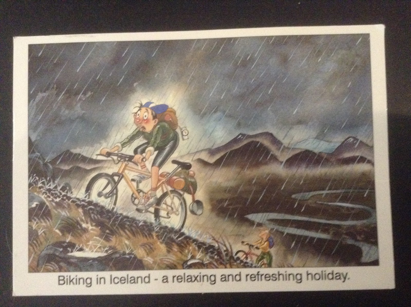
Postcard from my daughter last summer
If that goes well, next time I’ll probably go around the east and north coasts between Egilsstadir and Akureyri (both have airports), and finally across the south coast to or from Hofn, bussing one way.
The routes all substantially follow the coastline: this is almost all paved road, in good condition, at low level and with only moderate gradients. It’s where the population lives and the roads have to be usable in winter without ploughing. (The interior is uninhabited and most roads are gravel, rough and undulating).

I can’t contemplate off-road or much gradient any more than I can contemplate long sectors, because of the bike I’ll be riding: a Riese & Muller “Birdy”.  More on that in the next post.

Monday, 6 November 2017

All the Queen's Men


Fulminating about the Queen investing offshore is fairly stupid, and diverts attention from the real scandal of tax avoidance.

Firstly, this is 2% of her estimated fortune. 2 percent! As an allocation to this “asset class” it is really quite modest.  Life insurance companies, pension funds, charitable foundations probably all allocate more – possibly as much as 6-7%.

Secondly, HM appears to be participating as a “limited partner” in collective investment schemes. HM will be one of perhaps 100 or more high net worth investors in any one fund, with a small percentage of any one fund’s assets – the modest involvement in Brighthouse certainly suggests a fraction of 1% interest there.

Most of the investors in funds like this are governments (sovereign wealth funds), pension funds (private and public), and charitable foundations. You might well find fellow investors include The Ontario Teachers’ Pension Plan Board, GIC (the Singapore government social security fund), Surrey County Council pension fund, the Wellcome Foundation, and an Oxbridge college or two.  In fact, it is fairly likely that your own pension arrangements, if they are an occupational scheme, are involved in the offshore fund sector!

One thing all these entities share is this – they are exempt from tax anyway.

Such funds are almost always set up as Limited Partnerships. These might be useful for tax evasion (because the information is outside the UK’s domain, although that is about to change as the “Common Reporting Standard” comes into force with effect from 1 January 2017) but they are useless for avoidance (ie legal if immoral tax mitigation) because partnerships are fiscally transparent – their members are, in law at least, liable to report and pay tax on their individual shares of the partnership’s profits.

Most investors in such schemes wouldn’t have to pay tax anyway, and HM is one of them. She is exempt from tax, for the simple reason that Her Majesty’s Customs & Excise are collecting Her Majesty’s Revenue.

Sure, there are elements of offshore fund structures which don’t bear much scrutiny. The main tax saving they achieve is on VAT on management fees, and they may be exploiting lax regulatory standards applied outside the major economies, but the funds are only open to professional investors writing seven-figure cheques, and you might think they should be able to look after themselves.

Beside this, there is of course a huge industry in hiding income or capital from the eyes of the taxman, or laundering proceeds of crime, but can we focus on that please?

Friday, 23 September 2016

Bixing around Montréal

We recently returned from our fourth visit to Montréal, and the first in which we used the Bixi hire bike system.

Our first visit in 2014 was in February, for a prospective students’  open day at McGill, and only the most intrepid Montréalers cycle then. No 2 was in August of that year – we were mainly occupied with new parents’ receptions and events so all I managed was a quick try-out, mainly because I had never used the identical London hire bikes and wanted to see what they are like.

No 3 was August 2015. We walked – and walked, ending up with very sore feet. Montréal is perhaps half the size and population of London and a comparable trip – the Old Port to Rue Sherbrooke is like Charing Cross to Euston Road – is about 2/3rds the distance, so it’s a walkable city, up to a point. We hired bikes for a day from Fitz & Follwell to tour the Lachine Canal and St Laurence riverside, but that is all. Our daughter at this stage was just moving into a rented apartment after her first year in student hall close to the campus, and so we got her a bike from F&F (which sadly no longer sells bikes, apart from its hire bikes when they come to be replaced).


A year on, and daughter announces that she travels everywhere on her trusty Breezer Downtown (a kind of American Pashley Poppy) and if we want her to show us around, we are going to have to follow her on Bixis.
Daughter on "Judi Dench" (don't ask...) with some
of the Plateau's celebrated street art behind.
(It’s a tribute to a decent bike and a decent, albeit far from perfect, cycling environment that this SW Surrey born-and-raised girl has moved away from the attitude of her set, ie bikes are for losers and you get your provisional licence on your 17th  birthday, to embracing urban utility cycling)

How does the Bixi system compare with, say, hiring a bike by the day from a retail outlet? Well, it is certainly cheaper. The basic daily rate is $5 – you can buy three days for $14 but it is barely worth the saving, or if you reckon on getting more than 6 days’ use it would make sense to buy a 30 day subscription for $30, and get the smart key which saves you slotting your credit card into the machine and printing off an unlock code every time. (If you're racing to get the last bike in the dock before some other bugger beats you to it, that could be an advantage). Of course the cost doesn’t necessarily end there, as you may occasionally need to incur overrun charges ($1.75 0-30 mins, add $3.50 31-60, then add $7 61-90 etc) and you really do need to use the Bixi App to find available bikes or spaces, so you are into data roaming charges from your mobile provider. It probably still compares favourably with $25 a day for a retail hire though. And don’t forget tax. Never forget tax!

You are also spared the hassle of owning/renting a bike. No worries about punctures or maintenance issues, no need to lock them up. If there is a problem with a bike, dock it, wait 2 minutes and take another one.  Dock when you’re done and get another one when you have finished your coffee or shopping.

After that, it is mainly disadvantages. Bixis are heavy and cumbersome and low-geared and slow (although a tourist probably doesn’t mind a leisurely pace – you notice more of your surroundings like that).

You really do need to break trips into <30 minute sectors too, so you avoid the overrun charges which can quickly mount up (as some unwary users have found to their cost) and our experience was that the 2 minutes it takes before you can take a new one can see a docking station totally denuded, hence the need for the app to locate the nearest alternative (never very far, but usually not in line of sight). This happened to us when we rode back from Atwater to the Plateau Mont Royal along Boulevard Maisonneuve cycle path, which takes more than 30 minutes, and “changed horses” at Peel Street.

Unlike your own or a hire-bike, you have to walk the final leg, you can’t just stop right on the doorstep of the shop/café/museum you want to visit, (or even closer, as described in this little doggerel about naval dockyard workers in Portsmouth in the old days).

Montréal is a reasonably sympathetic environment for cycling, but isn’t perfect. There is probably more cycling in the Plateau (a kind of Shoreditch on Steroids) than the rest of the city combined, and even here, the kerb-separated cycle tracks still leave you exposed at junctions. Montréal is an exception to the common rule in North America permitting right turns on red, and motorists are by and large considerably more careful and courteous than in London, but for novice or nervous riders it can still be a little intimidating.

But, we saw immensely more of the city than we would have done on foot or public transport, and Montréal has enough to keep you busy for weeks. You could spend an entire week in the Plateau Mont Royal district for example, and still not have seen everything – Parcs Lafontaine and Wilfrid Laurier, Jean-Talon market, Mile End. Bars, cafés, microbreweries and bagel bakeries etc. And the street art.

A stall specialising in mushrooms in Marche Jean-Talon. Also a
good source for that signature Quebec product - Maple Syrup
A couple of cycle excursions which are worth doing: along the Lachine Canal, stopping at Atwater Market, to the St Laurence River and back along the riverside to Old Port, 40-45 km in total, and The Plateau to the Olympic Park, Biosphere and Botanical Gardens along the Rue Rachel cycle track. A Bixi wouldn’t be recommend for either – for one thing it would be unduly hard work, and for another the docking stations are either non-existent or availability of bikes or spaces is simply too uncertain. You would just have to swallow hard, and take the overrun charges.

Tuesday, 17 May 2016

Quayaxing


Quayax (v.t.) to move or transport a kayak by bicycle.

You may by now be familiar with the new verb to “Quax” – to perform an errand, such as shopping for groceries, on a bicycle, where many people might believe it can only be done with a private car. It derives from the Auckland, NZ politician who apparently couldn’t conceive how anyone could go shopping on a bike.

I already regularly go into town and to the supermarket on my “shopper”, an omafiets-style German bike by the snappily-named VSF Fahhrad Manufaktur (which I think means something like German Cycling Federation Bicycle Makers). It’s a mile and a half away and the time penalty of cycling instead of driving is more than recovered through not having to search for a place to park, walk over to the ticket dispenser, walk back to the car etc. Plus I save £1 in parking charges. Traditional quaxing.

Now, I thought, when I’m on holiday, could I transport my kayak behind my bike?  The beach is only perhaps 10 minutes walk from our house but dragging the kayak on its trolley is a bit tedious, and car-topping it is completely unjustified, quite apart from the difficulties of parking the car by the beach in high season.

So, could I tow it behind my bike?  In principle, I suppose I could just tie the end of the kayak to the back of the bike and pull it on its trolley but a typical kayak trolley has a fairly narrow wheelbase, and if you take a turn at any speed it would topple.
A typical kayak trolley as sold on Ebay


I looked online for bike-towed kayak trolleys and I found a couple but they were eye-wateringly expensive. One guy in British Columbia could sell you one for about C$700, plus another C$150 to ship it here, but that is almost the cost of the kayak itself.

So, I set to work figuring out how to make one myself.  The task was simplified by the fact that the kayak is the “sit-on-top” variety – instead of sitting inside the hull, you sit on a fully-sealed polythene shell, which has “scupper holes” to allow water to drain out from the seat well. The trolleys use the scupper holes to support and hold the kayak, using alloy tubes poking up vertically through them. Three metres of assorted 25mm alloy tube, some tube connectors as used to assemble clothes railings for shops, and a pair of trolley wheels later, and I had my raw materials.

One metre of a thick-walled tube forms the axle, with holes drilled at either end to hold R-clips, which keep the wheels in place. The kayak is 75cm wide so the 1 m wheelbase provides adequate stability to keep the centre of gravity between the wheels.


Two metres of a thinner walled tube form upright bars and a framework to support the kayak above the level of the wheels, all held together with T-section or five-way chromed steel tube connectors.


Finally, a small hole in the stern post of the kayak, provided to take the hinge pin of a rudder, makes the tow hitch. A 6mm drop-nosed pin, as sold in any good marine chandlers, acts as a tow hook, through a hole in a piece of 2x1 timber battening attached to the rear pannier, to position the hitch point behind the back of the rear wheel.


Simples!

Riding into the sunset


So there it is. 39 years working in central London. 33 of those around Fleet Street. 30 years commuting into Waterloo from South West Surrey. The First 20 walking the final stage, the final 10 on a bicycle. Prior to 2006 I would not have contemplated the journey by bike. The section from Waterloo to Blackfriars Rd either via Belvedere Rd and Upper Ground, or through the back streets via Roupell St was OK, even if the surface on Belvedere Rd is utterly crap and the loading vehicles and buses coming at you on the wrong side of the road can be tiresome – the pavement is mainly on the same level so you can escape if necessary. However the shit-sandwich which was the cycle lane between two lanes of fast motor traffic on the northbound carriageway of Blackfriars Bridge, with buses crossing from left to right, and vehicles crossing from right to left to zoom down the large-radius turn onto the Embankment slipway, was quite enough to put me off. I would just as soon have swum across the Nile.

It took a death, actually the second death, of Physiotherapist and Guys/StThomas Trust employee Vicky McCreery, majorly contributed to by this road layout, although I recall the bus driver who killed her was convicted of something as a result. (Ironic then that her employer is now whipping up a petition to oppose floating bus stops on the south side of Westminster Bridge on spurious and evidence-free pedestrian-safety grounds).
With what qualifies as lightning speed for a local authority building a cycle lane, the layout was radically altered. The pavement was widened, three traffic lanes were reduced to two, and a cycle lane was made with the difference along the kerb line. Traffic lights were installed on the sliproad and its turn geometry was tightened to cut the speed at which vehicles could take the turn. For a while, I counted how any cyclists passed me in the time it took me to walk from Doggetts pub to the traffic lights on the other side of the bridge, at virtually the same time every morning. I noted the numbers treble before I bit the bullet, dusted off my vintage Brompton, and started to ride.

I still managed to suffer three left hooks on this junction, each and every one being a taxi, each and every one racing to beat the traffic light as it went amber. “Amber-gambling” with my life. The third time finally hospitalised me, albeit months later when the shoulder injury didn’t respond to physio or drugs.

But I think Blackfriars Bridge galvanised the cycling community, and it contributed to a change of emphasis at LCC, moving it in the direction of greater activism and the eventual “Go Dutch” campaign. The bridge saw more than one flashride which attracted four-figure numbers of cyclists.

Now we have the two new cycle superhighways, one north-south across Blackfriars Bridge and the other meeting it along the embankment under the Blackfriars underpass. The sliproad down to the embankment where I suffered my three left hooks is now for cyclists only.

And it is not just cyclists who have benefitted, despite the City of London's whining about them in their submissions to the consultation.  We have a pedestrian crossing over Stamford Street, scandalously absent in all the years I previously walked that route. We have crossings of Fleet Street and Ludgate Hill at Ludgate Circus, also previously non-existent. We have re-instated a crossing at Blackfriars Junction which existed for a few short years before being removed again in the remodelling of the road layout last before the current changes.

None of these developments has made, in my anecdotal experience, any measurable difference to traffic congestion. Perhaps it has improved it but I am sure it hasn’t made it any worse. The loss of the third lane back in 2005 or so certainly didn’t have a noticeable impact, possibly because all that lane-changing was mightily disrupting the flow before.

We can thank Boris Johnson, in almost every other respect a complete disaster for London, a very clever but shallow, lazy, not-into-detail and self-absorbed individual, for the installation of the superhighways. We can applaud Andrew Gilligan for persevering in his part-time role as cycling commissar, proving that not all journalists are hacks. But frankly, would any of this have happened without active agitation by cycling campaigners, both individually and collectively via LCC? Would Boris, personally an active utility cyclist but one who is apparently content to use ordinary roads “as long as you have your wits about you”, have responded so positively without the 150 or more large London corporations, including my own (for one more week) employer, Deloitte, who supported the campaign? In some cases clients or suppliers of one well-known nay-sayer who, rumour has it, have been exposed to and shrugged off not-very-subtle threats as a result?

Whatever, I am glad that I have lived and worked to see these cycle routes finally opened officially for use, even if I only get about a dozen days of usage before I retire back to the Sussex borders.

Thursday, 28 April 2016

Tudor Street - the Truth


So, the Pre-Cambrian cretins on the City of London’s Court of Common Council have overruled their Pplanning & Transportation Committee’s decision to support the closure of Tudor Street at its junction with New Bridge Street.

The decision apparently follows fierce lobbying by senior figures in the Inner Temple, including Baroness Butler-Sloss. Their logic?  Apparently it interferes with deliveries to Temple and would prevent film crews accessing the area for filming, which would deprive the Temple of some revenues.

So, what access, apart from the eastern end, is available to vehicles wishing to go to or deliver in Tudor Street?
 
Well, you can enter from Fleet Street via Salisbury Court or Bouverie Street, and you can exit to Fleet Street via Whitefriars Street.  It is planned that you can enter or exit to New Bridge Street via Bridewell Place, and you can exit to New Bridge Street via Watergate, which brings you out next to the Unilever Building. Not exactly no choice!
 
Left-turn lane for New Bridge St traffic to turn into Bridewell Place. To permit turning into Tudor St TfL would need to provide a similar lane there, and there isn't room there.
The cycle lane just north of Bridewell Place. Note the eye-level traffic signal - this junction has always been light-controlled. The Tudor St/New Bridge St junction never has been.
Temporary barriers at Tudor St. It is however clear that TfL was not contemplating left-turning traffic into Tudor St, or they would no doubt have given it a nice wide turn radius! At the moment, traffic is permitted to exit Tudor St turning left/north - that is all.
 

The streets to the south, towards Embankment, are largely filtered now and I understand that TfL wants Temple Avenue to be filtered too.

How do these access points work out, for large commercial vehicles – you know, like film crew trucks?
There is actually ample space for two HGVs to pass each other here - or there would be.
 
Yes, parking bays and a taxi stand already constrict access fairly tightly, as this photo I took this lunchtime demonstrates – the eastbound HGV mounting the pavement to make space for a westbound HGV to pass through the narrow gap. I didn’t photograph it, but I also noted that in Whitefriars Street the no parking, no loading “At Any Time” markings were being constantly and routinely flouted, further obstructing the passage of vehicles.

And when a large vehicle – you know, a film crew’s truck – gets to the end of Tudor Street where the gate into Temple can be found?  Well, this is what they will find.
The sign says "Vehicle Restrictions: 3.4m high, 2.4m wide" Large enough for a film truck, say?
 

A bit like the Needle’s Eye in Jerusalem which apparently gave us the famous Biblical quote about camels.

So what is the fuss really about?  Yes, this:


And in case you couldn't read that sign...


Yes, there may be some notable senior QCs who have not yet lost the use of their legs, but apparently not many.


Wednesday, 6 April 2016

Musings


I recall reading somewhere – probably graphics on tweets – that the nationwide average distribution of car trip lengths is: 25% are under a mile, 50% under 3 miles, 66% are under 5 miles.  The average car trip overall is 11 miles. (Those short trip percentages for inner cities broadly translate miles into kilometres – so 2/3rds of inner-urban car trips are under 5km/3 miles. I haven’t seen a value for inner-city average trip length but I would guess rather less than 11 km)

I’ll make some crude assumptions: all those trips under 1 mile are exactly 1 mile, etc. These would flatter the results below but the point is substantially the same.

On these assumptions, shorter car trips which account for 2/3rd of all trips actually only account for 15% (or less) of all car mileage driven, because of the effect of a small proportion of much longer trips. So if all shorter trips were walked or cycled instead, this would make hardly a dent in the overall use that a typical car owner made of his or her car, in mileage terms at least. That might well explain why the world’s most active cycling nation, the Netherlands, has a very similar level of car ownership to the UK or other western European states, and (as far as I can tell) wears them out over about the same number of years. The fact is, they drive almost as much as we do.

But they walk/cycle circa 40% of short trips, compared with about 2% here.

It is not the total miles driven that determines traffic congestion – and I would guess that the relationship to emissions/pollution is far from linear – because longer trips must generally be on more open roads.  (Unscientifically, it “stands to reason, innit” that no sane person would crawl along at walking pace beyond a certain limit before they decided that it isn’t worth the candle.  Although the concept really belongs to daily commutes, there is a kind of “Marchetti Wall” effect that determines travel distances in terms of how long people can tolerate. Purely anecdotally, having been a small child before any of the modern motorways were even built, I can recall that the arrival of the M1 and the M6, even when they were shorter and less continuous than they are today, incentivised my parents to pay far more frequent visits to my grandparents in Sheffield and Ambleside respectively. But I digress.)

What determines congestion is the number of trips occurring in one place at the same time.  For example, it is not the long-distance road hauliers, travelling round the M25 from one motorway to another, say the M2 to the M1 or the M4, which create the congestion on the M25 at peak hours.  The M25 was in principle built for them and for other long distance drivers but, apparently to the complete surprise of the government’s traffic planners, who clearly have no understanding of the concept of induced demand, it brought about huge numbers of trips which join and leave the M25 within 2 junctions – purely local trips, probably more than 5 miles but quite possibly less than the average 11. Trips which perhaps, to some extent, were previously made on local roads – oh, how I remember hacking (in the back of my dad’s car) through Ascot, Bagshot etc before the M25 was built – but to a greater extent simply weren’t made at all. Or trips generated by the ribbon-development which road building brings about, and which largely explains the enthusiasm of some local (landowning) supporters of schemes like the Norwich Northern Relief Road.

But, as a message, incentivising walking and cycling does not mean, for most of the target audience, giving up their beloved cars or even actually reducing their use all that much. It represents minimal threat to the interests of the motor manufacturers, who must surely be behind most of the lobbying both for road building and widening and, in a subtle “don’t you think it is too dangerous without helmet and high-vis?” way, against cycling. They have motorways in the Netherlands. They call them Autowegs there.  They generally have smoother, quieter, more expensive surfacing than our motorways and are in better condition. Their maximum speed limit, at 130kph, is fully 10 mph faster than ours. And they don’t even have, comparatively, so much of an automotive industry to believe their economy can’t manage without.

So what is it that our politicians, notably Zac Goldsmith and Sadiq Khan, are so afraid of?